
Satellite-Based Train Positioning Systems (SBGPS) are technologies that use satellites to track and monitor the exact location of trains as they travel along the tracks. This system is like a GPS for trains, helping to know where a train is in real-time. Let’s break it down in simple terms:
1. What is a Satellite-Based Train Positioning System?
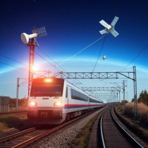
This system uses satellites (similar to the ones in your phone) to track the position of a train. Just like how you can use Google Maps on your phone to find out where you are, the satellite system helps train operators and control centers know exactly where a train is on the tracks.
2. How Does It Work?
The system relies on GPS satellites, which are placed high above the Earth and continuously send signals to the ground. Here’s how it works:
- GPS Receivers on the Train: The train has a GPS receiver installed on it. This device picks up signals from multiple satellites in space.
- Calculating the Position: By measuring how long it takes for the signals to reach the train, the GPS system can calculate the train’s exact position (its latitude, longitude, and altitude) on the Earth’s surface.
- Updating Location in Real-Time: The system updates the position constantly, so the location of the train can be tracked in real-time.
3. Key Components of the System
- Satellites in Space: These are the sources of signals that allow the GPS system to determine the train’s location.
- GPS Receiver on the Train: This device collects the signals from the satellites and uses them to calculate the position.
- Control Center: The location data from the train is sent to a control center or central system, where operators can monitor the train’s position and movement.
4. Why is Satellite-Based Positioning Important?
- Accurate Location Tracking: Traditional methods, like trackside signals or radio systems, might not always give accurate data. Satellite-based positioning provides precise, real-time location updates for better tracking and decision-making.
- Improved Safety: By knowing where every train is, railway operators can avoid collisions or delays. For example, if two trains are too close to each other, the system can warn the operators and help manage train schedules more efficiently.
- Better Train Control: The system can help operators control the speed and movement of trains. If a train is moving too fast, the system can provide alerts or adjust its speed automatically.
5. Benefits of Satellite-Based Train Positioning Systems
- Real-Time Monitoring: Trains can be tracked in real-time, so operators know where they are at any moment. This helps with coordination and decision-making.
- Enhanced Efficiency: Knowing the exact location of each train makes it easier to plan schedules, reduce delays, and avoid overcrowding on tracks.
- Improved Train Scheduling: Satellite tracking helps optimize train schedules by giving accurate data on when a train will reach its next station. This reduces waiting times and makes the system more efficient.
- Increased Safety: The system can detect dangerous situations like a train going off course or approaching a red signal. Alerts can be sent to prevent accidents.
6. How is the Data Used?
The data from the satellite system is often displayed on computers or mobile apps for the operators. This helps them:
- Monitor Train Progress: The control room can see where each train is and how it’s moving.
- Predict Arrival Times: Knowing the position helps predict when trains will arrive at stations, improving customer service.
- Manage Delays: If a train is delayed, operators can adjust schedules or reroute trains to avoid problems.
7. Additional Features of Satellite-Based Systems
Some advanced satellite-based systems also include:
- Integration with Other Systems: These systems can be combined with other technologies, like Automatic Train Control (ATC) or Automatic Train Protection (ATP), to enhance safety.
- Weather and Obstacle Detection: In some cases, the system might also be integrated with weather data or sensors on the train to alert operators about potential issues (e.g., if the train is approaching a flooded track or has mechanical problems).
Conclusion
Satellite-Based Train Positioning Systems use satellites to provide real-time, accurate location data for trains. This helps improve safety, efficiency, and scheduling for rail networks. It allows operators to know exactly where a train is at any time, making it easier to avoid delays, prevent accidents, and offer better service to passengers. It’s like having a GPS for trains that ensures everything runs smoothly on the tracks!
Keywords: Satellite, Railway
 : Explain")


