

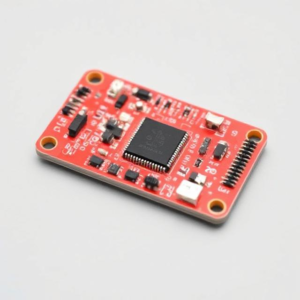
GPS Module Integration:
A GPS module is a device that allows electronics to determine their location (latitude, longitude, and sometimes altitude) anywhere on Earth using signals from satellites. Integrating a GPS module into an electronic system lets you add location-tracking features to your project, such as in smartphones, navigation systems, or tracking devices.
Here’s an easy way to understand how you can integrate a GPS module into your electronic system:
How GPS Works:
- Satellites in space: There are many satellites orbiting the Earth that send signals. These signals contain information like the satellite’s location and the time the signal was sent.
- Your GPS module: The GPS module on your device listens for these signals. By receiving signals from at least four satellites, it can calculate the exact location of your device.This process is called triangulation. The GPS module calculates how far away each satellite is from the device based on how long it takes for the signals to reach it. From this, it can figure out your exact position on Earth.
Key Components of a GPS Module:
- Antenna: The GPS module has an antenna that receives the satellite signals. It is usually an active antenna that amplifies the signals.
- Receiver: This part receives and processes the satellite signals.
- Processor: It decodes the signals and calculates your exact location using algorithms.
- Interface: This allows the GPS module to communicate with the device you’re integrating it into. Common interfaces include UART (serial communication), I2C, or SPI.
Steps to Integrate a GPS Module:
1. Choose the Right GPS Module:
- There are many types of GPS modules available, and some offer extra features, such as altitude, speed, or heading information. You’ll need to choose one that suits your needs.
- Popular GPS modules include the Neo-6M, Neo-M8N, and u-blox GPS modules.
2. Connect the GPS Module to Your Circuit:
- Power: GPS modules usually run on 3.3V or 5V. Connect the VCC pin of the GPS module to a power supply (like the 3.3V or 5V rail of your microcontroller).
- Ground: Connect the GND pin to ground (common with the system).
- Data Communication:
- Most GPS modules communicate via serial (UART), so you’ll need to connect the TX (transmit) pin of the GPS module to the RX (receive) pin of your microcontroller and vice versa.
- If the GPS module uses I2C or SPI, you’ll need to connect the corresponding pins for communication (SDA/SCL for I2C or MISO/MOSI/CLK for SPI).
3. Set Up the Communication Protocol:
- If using UART, you can use a serial communication library or protocol on your microcontroller to read data sent by the GPS module.
- For I2C or SPI, you would use the corresponding protocol library to communicate with the module.
4. Reading GPS Data:
The GPS module sends data in the form of NMEA sentences. These are standardized text strings that include information such as:
An example NMEA sentence might look like this:
- Latitude and Longitude
- Altitude
- Time
- Speed
$GPGGA,123456.00,4916.45,N,12311.12,W,1,12,1.0,500.0,M,-34.0,M,,*42
The GPS module sends this data continuously, and you can use software (like a microcontroller program) to parse these sentences to extract useful information like location coordinates.
5. Interpret the Data:
- Once you receive the NMEA sentence from the GPS module, you need to decode it in your software. This involves extracting relevant parts like:
- Latitude and Longitude: These values tell you the exact location of the device.
- Altitude: Some GPS modules provide altitude data (height above sea level).
- Timestamp: Some GPS modules also provide the current time based on UTC.
- Your code can then process or display this data, such as showing the location on a map or using the coordinates for navigation.
6. Display or Use the Data:
- After getting the GPS coordinates, you can use them in your project. For example:
- Mapping Apps: Show the location on a map using a screen or app.
- Tracking Systems: Store the location data for tracking movements over time.
- Navigation: Use the data to guide the user from one place to another (like in a GPS-enabled device).
Advantages of GPS Module Integration:
- Location Tracking: You can easily add location-tracking capabilities to your projects.
- Global Coverage: GPS works globally, providing location data anywhere in the world.
- Low Cost: GPS modules are relatively cheap and easy to integrate into your system.
Challenges:
- Signal Issues: GPS modules require a clear line of sight to the sky to work properly. They might not work well indoors or in places with poor satellite visibility (e.g., tunnels or dense forests).
- Power Consumption: GPS modules can consume more power, so battery-powered systems need to consider power efficiency.
- Accuracy: GPS accuracy can vary depending on factors like satellite positioning and environmental conditions. Typically, consumer-grade GPS modules have an accuracy of around 5 meters.
Conclusion:
Integrating a GPS module into your electronic project is a great way to add location-based functionality. By connecting the GPS module to your microcontroller or processor and reading the data it provides, you can track your device’s location, use it in navigation systems, or even store location data for further use. With just a few connections and some basic coding, you can easily bring powerful GPS capabilities to your electronic systems.
Keywords: GPS, Electronics